The CMMPO strives to create a comprehensive and holistic approach to transportation that includes biking and walking as integral parts of the region’s multi-modal transportation system. In doing so, the CMMPO incorporates Complete Streets principles into project planning and implementation, embraces micromobility options (i.e. e-bikes and bikeshare programs), and adapts to the region’s evolving transportation needs. Moreover, many member communities are pursuing investments to complete the regional trails network for recreation and commuting purposes.
Pedestrian and Bicycle Planning
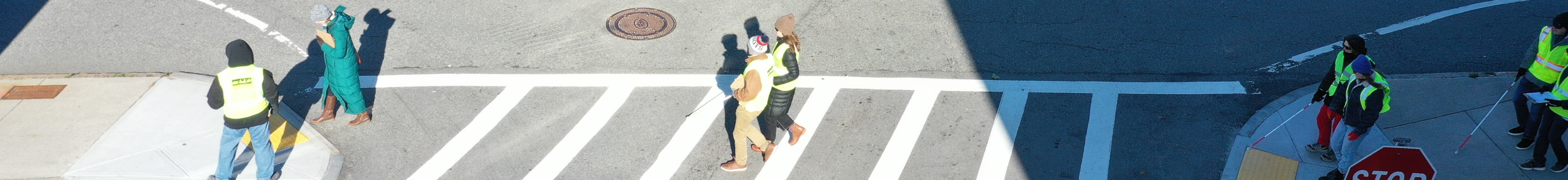
Central Massachusetts is committed to bicycle and pedestrian mobility. As transportation costs and congestion increases, cost effective, healthier, and environmentally conscious methods of travel are of paramount importance. A comprehensive, multi-modal strategy that includes walking and bicycling as an integral part of the region’s multi-modal transportation system is crucial.
In cities and towns across the nation, safe accommodations for all users have become a key factor for measuring a community’s quality of life. Improved availability of efficient, accessible, and safe walking and bicycling networks plays a strong role in making a region more economically competitive and attractive to public and private investment. The re-energized momentum of active transportation in the region supports the CMMPO’s vision to close gaps and create an accessible, convenient, and connected pedestrian and bicycle network.
The greatest regional challenge, as recognized on the LRTP, 2050 Connections, is the lack of pedestrian and bicycle facilities.
Regional Plans
The CMMPO Regional Bicycle Plan and CMMPO Regional Pedestrian Plan identify the opportunities for encouraging and enhancing pedestrian networks and bicycle travel within the CMMPO region. The recommendations included in the plans serve as a guide for local jurisdictions to take advantage of these opportunities. The intent of these plans is not to secure funding for every project, but to identify potential opportunities. Implementation of the recommendations of these plans will provide for a comprehensive pedestrian and bicycle transportation network that is focused on accessibility, mobility, and safety.
2025 Regional Bicycle Plan Update!
The CMMPO has completed the 2025 update to the Regional Bicycle Plan! Please find links to the Plan and to the accompanying Technical Appendix below.
The goals for the 2025 Regional Bicycle Plan are:
- Continue the development of a safe regional bicycle network that encourages mode shift
- Support local communities in the implementation of bicycle projects while addressing connectivity gaps in the regional network
- Identify short- and long-term potential improvements
Please contact Adam Wriggins, Associate Planner, awriggins@cmrpc.org, for more information on Bicycle and Pedestrian Planning.
2025 Regional Pedestrian Plan Update!
Staff at CMRPC are beginning to work to update the Regional Pedestrian Plan. The first step is to gain valuable feedback from community members. Use the link below to access the Pedestrian Experience Survey, where you can share your thoughts, feedback, and input to create a more walkable Central Massachusetts. Share this survey with friends, family, and anyone who is interested in walkability.
Previous Plans
2021 CMMPO Regional Bicycle Compatibility Index (BCI)
New planning tools like the BCI methodology, formulated by the FHWA, provides a comfort level analysis of roadways in terms of its compatibility to easily integrate bicycle infrastructure, while also determining the perceived safety of bicyclists. The BCI is intended to support stakeholder decision making in prioritizing segments to build upon the region’s multi-modal network. It considers the presence of a paved shoulder or bicycle land, bicycle lane width, travel lane width, vehicle volume, the posted speed limit, the presence of on-street parking, the surrounding land use, and the slope.
Segments with a score of A and B are identified as the top priorities in the region for bicycle facilities. The segments with a score of C are included as second tier priorities. Below are links to the 2021 Regional Bicycle Compatibility Index and a map that illustrates BCI priority results in the CMMPO region.
Bikesharing Exploration in the CMRPC Region
CMRPC staff have been exploring bikeshare opportunities throughout the region as an active, alternative mode of transportation. Through these efforts the Exploring Bikeshare Opportunities in the CMRPC Region report was developed.
The report dives deep into understanding how bikeshare models can be successful at rural and suburban levels with supporting case studies and the defining geographic, demographic, and economic characteristics that have an effect on a regional bikeshare system.
Because these characteristics vary across the region, the exploration takes into consideration the different approaches needed to implement bikeshare at the community level. The report is not a direct recommendation for the region or specific communities, but is an exploration of the opportunities within the region that are supportive of bikeshare systems.
Complete Streets
What is Complete Streets?
CMRPC’s Complete Streets Program is focused on helping our communities adopt the principles of Complete Streets and participate in the MassDOT Complete Streets Funding Program. Complete Streets are roadways that safely and comfortably accommodate all users, regardless of age and ability or mode of transportation. Users include, but are not limited to, motorists, bicyclists, pedestrians, public transportation riders and providers, emergency response vehicles, freight operators, and school buses.
What Goes into Complete Streets?
Complete Streets components can include roadway design features such as ADA compliant sidewalks and crossings, curb extensions, bicycle lanes, shared use pavement markings, bus shelters and pull-outs, wayfinding signage landscaping, street lighting, and many other items.
Our Services
The CMRPC Transportation Staff provides grant assistance for the Complete Streets Program. This includes assistance with Policy (Tier 1), Prioritization Plan (Tier 2), and Construction Application (Tier 3). Additionally, CMRPC Transportation Staff services as a liaison between its communities and MassDOT.
Project Status
About half of the communities within the CMMPO region have received Complete Streets funding, but much more is needed. Currently, based on all the projects included on the approved Prioritization Plans, there are 841 planned Complete Streets projects in the region. These projects total an amount of $256M. That would fix/replace or add an estimated 3,729 curb ramps and 274.8 miles of sidewalks. Below is a map showing funded and planned projects in the region as well as a link to the MassDOT website that shows current Complete Streets status by tier.
Complete Streets Toolkit
Our communities have improved local transportation by adopting the Complete Streets approach. Municipalities must collaborate with residents, ensuring decisions are community-informed, making effective outreach crucial. However, challenges like limited funding, staff capacity, and strained relationships exist. This toolkit provides practical strategies and successful examples from Central Massachusetts
Trails
Trails provide a means of recreation, tourism, and commuting for residents and visitors within the CMMPO region all while sustaining the highest level of user comfort, completely separated from vehicular traffic. Boasting over 700 miles of foot paths, water trails, mountain bike trails, and shared-use paths, the regional network is sure to satisfy any budding or seasoned enthusiast. Use the dropdowns below to learn more about the different trails in the region.
Blackstone River Greenway
The Blackstone River Greenway and Bikeway is envisioned as a nearly 50-mile greenway and paved pathway that will connect Providence, RI to Worcester, MA along the banks of the Blackstone River. Once fully completed, the greenway would connect 14 cities and towns in the National Heritage Corridor and eight towns in the CMMPO region, including the City of Worcester.
Boston Worcester Airline Trail (BWALT)
The BWALT is a proposed multi-use trail that runs from Framingham to Worcester with connections to networks in Marlborough and Berlin. The entire trail follows the route as the former Boston and Worcester Air Line Trolley and passes through three communities within the CMMPO region: Shrewsbury, Northborough, and Westborough.
French River Greenway
The French River extends 26 miles from its source in Leicester, through six other communities in the CMMPO region, and south to the Quinebaug River in Thompson, Connecticut. At least 1.2 miles of the French River Greenway is open to the public in Webster. The Town of Dudley will pursue connections to the greenway via the Stevens Mill Riverwalk. The greenway is envisioned to have positive impacts on the water quality as well as the nearby wildlife.
MassCentral Rail Trail (MCRT)
The MCRT is a 104-mile corridor that is envisioned as a shared-use pathway from Boston to Northampton. Today, 53 miles of this corridor have been completed and are available for all types of active transportation, connecting people to communities and other attractions. The middle 30-mile section of the MCRT is referred to as the central section and connects eight towns within the CMMPO region. This trail is identified on the MassTrails Priority Trails Network Vision list and once completed, will intersect with 17 existing trails, including the Bruce Freeman Rail Trail.
Grand Trunk Trail (GTT)
The GTT is a rail trail that runs along the old Grand Trunk Railroad in the municipalities of Brimfield, Sturbridge, and Southbridge. The GTT is part of the larger Titanic Rail Trail system, which extends through the southern portion of the CMMPO region and into Connecticut.
Quinebaug Valley Rail Trail
The Quinebaug Valley Rail Trail is a planned 11-mile trail that span along the old Southbridge and Blackstone Railroad line of the Providence and Worcester Railroad. This trail is one section of the Titanic Rail Trail, which extends from the Town of Palmer to the Town of Franklin and incorporates the GTT. This trail not only travels along the old railroad, but also the Quinebaug River. The Quinebaug Valley Rail Trail runs through three towns in the CMMPO region: Dudley, Southbridge, and Webster.
Southern New England Trunkline Trail (SNETT)
The SNETT is a recreational trail along the former railroad corridor that runs approximately 23.5 miles from the Town of Franklin’s State Forest to the Town of Douglas’ State Forest. Owned by the DCR, the SNETT is one of the longest rail-trails in southern Massachusetts, passing through six towns in the CMMPO region. The SNETT has the longest horseback riding trail in Massachusetts. For more information about horse trails in Massachusetts, visit AllTrails.
Ware River Valley Rail Trail
The Ware River Valley Rail Trail is a 25-mile rail trail that runs from Route 122 in Barre up to Templeton. From the northern half there are connections to the Town of Princeton, and from the southern half in Barre, there are connections to the MCRT. The remaining portion of the southern half of trail, from Barre to Ware, is a segmented section of the MCRT. The Ware River Valley Rail Trail passes through several towns in the CMMPO region including Barre, Hardwick, and New Braintree.
The Massachusetts Midstate Trail
Extending from Rhode Island, through Central Massachusetts, and into New Hampshire, the Midstate Trail is a 92-mile trail that not only connects various communities in the CMMPO region, but also three states. From the Douglas State Forest, through the Wachusett Mountain State Reservation, and up north through Ashburnham State Forest, this trail offers a wide variety of Massachusetts landscape features, including rolling hills, lakes, and miles of rural woods. The most popular and difficult horseback riding trail in Massachusetts is found in the Midstate Trail: East Hill Road, Rutland to Route 9, Spencer.